
National Historic Oregon Trail, Baker City, Oregon
The National Historic Oregon Trail is a significant route in American history that stretches approximately 2,170 miles from Independence, Missouri, to Oregon City, Oregon. In the 19th century, particularly from the 1840s to the 1860s, the Oregon Trail was one of the main overland migration routes on which hundreds of thousands of American pioneers traveled westward. They sought new opportunities, land under the provisions of the Donation Land Claim Act, and to escape economic hardship in the East. Travelers faced a grueling journey that could take up to six months. They navigated various terrains, including prairies, mountains (like the Rockies), and deserts, facing challenges like river crossings, diseases, and conflicts with Native American tribes. The trail facilitated the settlement of the American West, significantly contributing to the expansion of the United States. It led to the establishment of many towns, the spread of American culture westward, and the displacement of Native American populations.


The Approach
From I-84, take exit 302 for Baker City. Turn East onto High 86. A few markers before you reach the Oregon Trail Interpretive Center turnout.
Historical Marker - The Lone Tree of the Oregon Trail: 44.812031, -117.754056
Oregon Trail Centennial Obelisk: 44.810922, -117.743246
Oregon Trail Trailhead and Wagon Ruts: 44.808112, -117.731653
Oregon Trail Interpretive Center: 44.813938, -117.728696
Challenges
In the summer months, this area can get hot in the afternoon sun. There isn’t much shade, so plan accordingly.
Equipment
Sunscreen
Hat (optional)
The History of the Oregon Trail
The Oregon Trail officially opened in the early 1840s, but its roots trace back to earlier explorations. Fur traders and missionaries were among the first to venture into the uncharted lands of the American West. However, the economic opportunities, the promise of free land, and the lure of a new life galvanized thousands to make the perilous journey.
The trail began in Independence, Missouri, a bustling frontier town where pioneers gathered each spring to prepare for the journey. They traveled in covered wagons, often referred to as "prairie schooners," hauling all their worldly possessions. The route meandered through what are now several states, including Kansas, Nebraska, Wyoming, Idaho, and finally, Oregon.
The journey was fraught with challenges: snake bites, drowning, falling off horses, toppled wagons, disease, and encounters with bandits and American Indians. The journey was never completed by many. Some were able to turn back successfully from the journey, while others died in their attempted return trip. Some ended their journey early, settling in what is now Montana, Wyoming, Colorado, Utah, Idaho, Arizona, Nevada, and other states.
The 1840s and 50s saw the peak migration along the Oregon Trail. The Donation Land Claim Act of 1850 further incentivized settlers by offering free land to those who made it to the Oregon Territory, significantly increasing traffic. By the late 1860s, with the transcontinental railroad's completion, the need for such a grueling overland journey diminished.
Today, the National Park Service manages the Oregon National Historic Trail, with various sites, markers, and interpretive centers preserving its history. These sites offer insight into the lives of those who traveled the trail, from their daily struggles to the monumental achievements of reaching the West.
Visiting the Interpretive Center
Hours
Summer hours: 10 a.m. to 5 p.m. daily through Oct. 20. Closed Monday, Oct. 14, for Columbus Day.
Winter hours: 10 a.m. to 5 p.m. Thursday-Sunday.
Admission
https://www.recreation.gov/ticket/facility/10101989
Summer admission (April 1-Oct. 31): $8 for age 16 and up, $6 for seniors, good for two days with receipt.
Winter admission (Nov. 1-March 31): $5 for age 16 and up, $4 for seniors, also good for two days with receipt.
Fee Free Days 2024: Nov. 30-Dec. 31, 2024.
The Interpretive Center
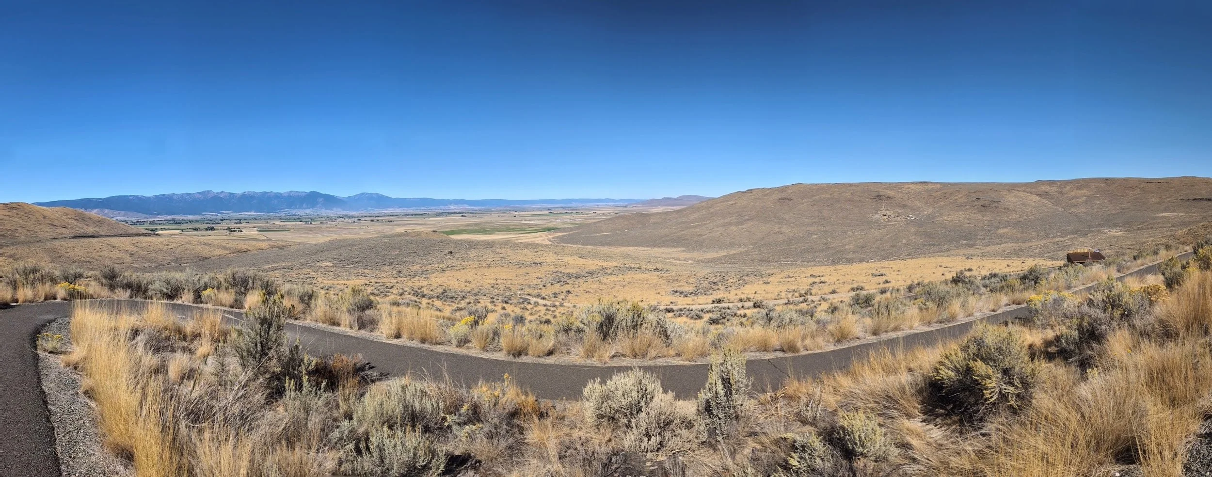
Before you reach the National Historic Oregon Trail Interpretive Center, I highly recommend stopping to check out the “Lone Tree of the Oregon Trail Historical Marker,” the “Oregon Trail Centennial Obelisk,” and the “Oregon TrailTrailhead and Wagon Ruts.” The culminating stop is the interpretive center.
There are three main parking areas. I recommend driving to the top parking area first and then going down if it is full. The middle and top parking areas have several parking spots for RVs and Trailers. They have a few covered picnic spots next to the top parking area. There is also a wagon circle near the picnic spots. As you reach the entrance to the Interpretive Center, you are greeted with a gorgeous rebuilt wagon behind a rope barrier.
Inside the doors, you’ll enter the foyer. To your left is a small gift shop with some reasonably priced items and some very expensive ones. To your right is an art gallery (art is not historical) and the theater. At regular intervals, the volunteers will play a documentary about the Oregon Trail. These videos can be informative and insightful, but we prefer to skip them. This particular one is around one hour in length. We preferred to use that time examining the multitude of stories, artifacts, and history displayed throughout the interpretive center.
Straight ahead is the beginning of the walking tour of the interpretive center. You can easily spend hours reading over every sign and pamphlet and watching the select videos shown along the tour. You can move at your own pace and take in as much as you want. We found some of the most impactful moments were pausing to reflect on the journey these brave people undertook in hopes of a better life. The sheer grit it took to pack what little you could, travel over great oceans, gather as many supplies as possible with little understanding of what awaited you, and then embark on one of the most dangerous journeys in history. Imagine the need for freedom being so great that it was all worth the effort. Incredible.
Near the end of the tour, you learn more about the mining that brought and kept many of these pioneers in this particular area. This lays the groundwork for the exterior walking path outside the center. The meandering pathway leads to a mine shaft replica. This was better than we expected because you are allowed to walk inside; typically, these kinds of locations are roped off to keep people out. Further along the path you’ll pass the back side of the Stamp Mill, then make your way around to the front to learn more about the mining process. Finally, there is a newly constructed blacksmith building that is so new it doesn’t even appear on Google Maps.
There is a trail that you can walk that extends out to a rocky outcropping and then loops back to the other side of the center. It also branches off to the Wagon Ruts as well. We did not travel these trails.
Summary
The story of the Oregon Trail is not just in the history books; it's etched into the very land of America. This was more impressive, in scale, than the other interpretive center we have visited. It is evident that it has received more funding than the Three Island Crossing Interpretive Center, and given that disparity, I think the Three Island Center is slightly more impressive. The Three Island Crossing Center is more localized to that specific area, while this Center tells the story of the entire journey. I enjoyed the stories and quotes that were the thread of this interpretive center. It created an incredible human touch for the entire experience. It is well worth visiting, and I hope to visit again to learn more about this historic and remarkable time in the history of America.
Places to Eat in Baker City
Sweet Wife Bakering has the most incredible eggs benedict. It really knocked our socks off. The chocolate hazelnut baklava was so delectable. You can’t go wrong with the breakfast burrito, either.
Eagle Cap Grill was a good lunch spot. Very small and cozy. It appeared to be the local watering hole.
Other Points of Interest
If you have the time, stop by the Baker Heritage Museum for a little history about Baker City (it was closed when we tried to stop by). While there, walk across the street to the Geiser Pollman Park. We absolutely fell in love with the Baker County Public Library that backs up to the Powder River and this park. We were so enamored with this historical downtown area that we even started looking at available properties there. We won’t be moving anywhere any time soon though.