
Mogensen Trail


Mogensen Trail is an almost 2.2 mile (3.54 km) there-and-back trail that is likely moderate difficulty (see notes below about the challenges).
Challenges:
Steep stairs you have to descend and then ascend upon your return to the parking area. This is the majority of the 279 feet (85.04 m) of elevation variance.
The trail along the Snake River has a few places that could be a little difficult if you have any stability or balance issues. Narrow wooden bridges and some shale could make it difficult.
WORD of WARNING: There is no cell phone signal reception down in the valley along the Snake River. Plan accordingly.
Google Maps Note: Ours kept telling us to turn on Blue Lakes Rd. off of highway 93 as you just enter Twin Falls, but it really should tell you to turn onto Canyon Springs Rd.
To reach the entrance to the trailhead, travel part way down into the canyon on Canyon Springs Rd. You will pass the Perrine Coulee Waterfall (if you have the time, stop and take a look at this natural beauty). A little further down the road you will see your road split into two with several parking spaces. This is your stop. If you take the left road, you will take Canyon Springs Rd towards the golf course. Keep following the road you’re on, and you’ll reach the Centennial Waterfront Park and the Centennial Boat Launch.
From the trailhead, you’ll get a great photo op just about 50 feet (15.24 m) in. You can climb up a little to a rock outcropping to get an even better view. Back on the trail and another 100 feet (30.48 m) or so and you’ll find the stairs leading down. Some steps are quite narrow, and you’ll want to be careful navigating this section. Take your time and use the handrail. A few of the metal steps have a slight give to them. Nothing too crazy, but if you’re not expecting it, you might not be ready for it.
At the bottom of the stairs is the largest wooden bridge. This bridge had a fair amount of plant debris on it. I think the overgrown bushes along the bridge were unceremoniously hacked down and left where they were. With the amount of traffic this area gets, I don’t foresee it being an issue for anyone.
After this bridge, it is a single lane trail the rest of the way. There will be plenty of areas for you to step off trail if someone needs to pass. There are also several trails that will branch off this one that lead mostly to the banks of the Snake River. If you’re not in a hurry, I suggest you take these small offshoot trails and enjoy the beautiful scenery.
The first waterfall of note you’ll come to is only about 8–10 feet tall, but is gorgeous. Someone hiking out stopped to fill his water bottle. The runoff created a lush green carpet of green grass and plants.
Take some time and enjoy the cool water spray. Wet a towel to wrap around your neck. Soak your hat in the cool spring water. You’ll especially like this on the way out before tackling the stairs going up, especially on a hot day.
Watch your first step onto the wood walkway. It is not exactly stable.
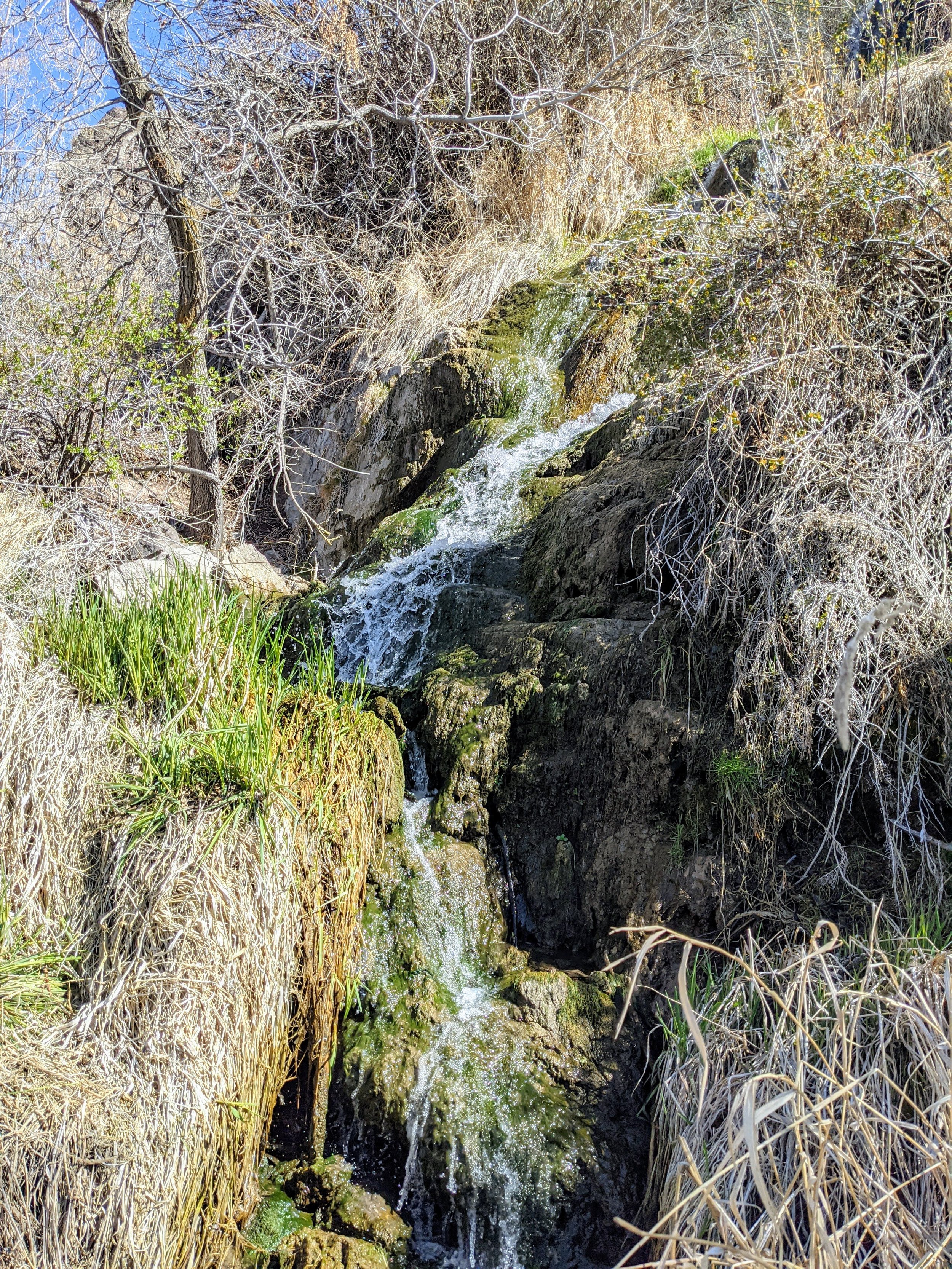
The second waterfall is a longer running waterfall that reminded us of a fairy garden waterfall. It meanders and cascades its way down through grasses and over rocks. It is a serene environment, and a great place to close your eye, breathe deep, stretch, and take in the beauty of the nature that surrounds you.
The small stream that continues down below the path is so cute and pleasant. I think we spent the most waterfall time at this one, just because it seemed to resonate with us and recharge us uniquely.
The remaining falls have to be admired from a distance.
The trail now leads you under the Perrine Bridge. This bridge is world-famous for base jumping. We were incredibly lucky to have been just reaching the landing zone as several base jumpers were stepping onto the bridge above. We spent the next 30 minutes watching them one-by-one jump and deploy their shoot. Some drifted slowly down to the ground, others quickly descended while doing a quick direction change along the way.
The trip from jump to landing was only a few seconds, but it was incredible to watch, and those doing the jumping seemed thoroughly thrilled with the experience of cheating death. It was a special treat to witness this event alongside the natural beauty we came to the trail for.
The trail officially ends with a view of the tallest waterfall of this hike. It is gorgeous, and I imagine as the spring runoff reaches this one it will be even more majestic. There are a few small trails that appear to lead you closer to this waterfall, don’t bother. The view gets more obstructed the closer you get, as you also close in on the tangle of brambles and trees that line the small creek that winds along the base of the canyon walls. This natural barrier also keeps you from getting right up next to this waterfall. We paused to appreciate the natural protection created to keep this waterfall unpopulated.
Note: The trail appears to continue on, but we did not proceed further. You may do so at your own discretion.
This water was a grander version of the fairy garden waterfall from earlier. It has the tall fall at the top with the meandering cascading river below. It was magnificent. Likewise, it was the ideal spot to take a small break and have a snack and some water to refuel. We reflected on the beauty we had enjoyed so far, as well as the incredible fortitude of mankind that we witnessed at the bridge. The moments passed slowly as we breathed deep of all that we have been a part of this day. Then we began our return hike.