
Halverson Lake Trail


Halverson Lake is a small and fairly shallow lake in Owyhee County that sits alongside the Snake River. The trailhead to the lake starts in Celebration Park about 7 miles south of Melba, ID. Celebration Park is neat, but we’ll discuss that in the next blog. From the park parking lot, you can hike to the trailhead or drive a short way down the dirt access road to the trailhead. Very few parking spots exist at the trailhead and some parts of the road may require a high-clearance vehicle. Hiking to the trailhead from the park parking lot only adds about half a mile to the total trip.
Challenges:
There appear to be a few trails, but they all lead to the same place as far as we could tell. You may want to have a navigation tool like AllTrails just in case.
The trails are narrow but are well worn without many tripping hazards to worry about.
There is very little elevation change throughout the hike. Accessing and leaving the lake was the most difficult part, and it was easy enough for small children and a few older adults we saw on our journey. If you have mobility issues, walking sticks would be a good option.
If you go in the spring, summer, or early fall bring water, sunscreen, and a hat. There is virtually no shade and it will be hot.
Equipment:
Water
Snack
Sunscreen (recommended)
Bug Repellent (recommended)
Hat (recommended)
Good, broken in, hiking boots or shoes
Weather-appropriate clothing
The Approach
Parking in the main parking lot next to the visitor center you can follow the dirt road East toward the trailhead. The road is a little less than a mile in length and even has a paved walking path on the south side of the road for a portion of the trek. You’ll pass by several camping spots that line the north side of the road. If unoccupied you might take a minute to check one out.
After passing by the camping spots you will continue to follow the road that quickly deteriorates to a much less maintained roadway. Continue to follow this road and you will reach the end, marked by a gate, and the start of the trail to Halverson Lake.
The Trail
The trailhead is marked by some informational boards and diagrams of the area. Take a minute to read over the information and learn a little more about the area. I won’t spoil it for you here. There are a few trails that branch off from the trailhead, but the main one was pretty easy to identify and follow. It takes you along the edge of the Snake River for a few hundred feet before bending more northerly, away from the river.
The views along the trail are both beautiful and interesting. The massive melon boulders that fill the landscape make the area seem strange and otherworldly. A large mound of lava rock even had me thinking of a particular scene in the original Jurassic Park movie. You’ll know the one when you see it. The canyon walls are impressive and the Owyhee mountains in the background create a picturesque scene. In the early spring, those mountains add to the view while still being snowcapped, creating a bold contrast to the dark melon boulders and lava rock cliffs of the river valley you’re standing in.
As the trail bends further north-northeast you begin to close in on your destination. This stretch is quite flat and easy to walk. It makes it easy to take in the views. Don’t get too distracted though, the trail is not maintained and is not straight. Lots of tripping hazards could ruin your trip if you aren’t watching where you are stepping.
You know you are getting close to the lake when you start to get a little elevation in your hike. It is not significant, but you will notice it happening. The lake is a little further than you would think when you reach this elevation gain, but you’re almost there. A few zigs and zags around some of the melon boulders and the lake suddenly appears.
Following this trail will put you at the easternmost tip of the lake. In early Spring the water level is fairly shallow and it provides some opportunity to scramble onto some boulders that would likely be inaccessible when there is more water. You can take any path you like around the lake, but you’ll want to eventually make your way to the southwestern side of the lake to find the trail out.
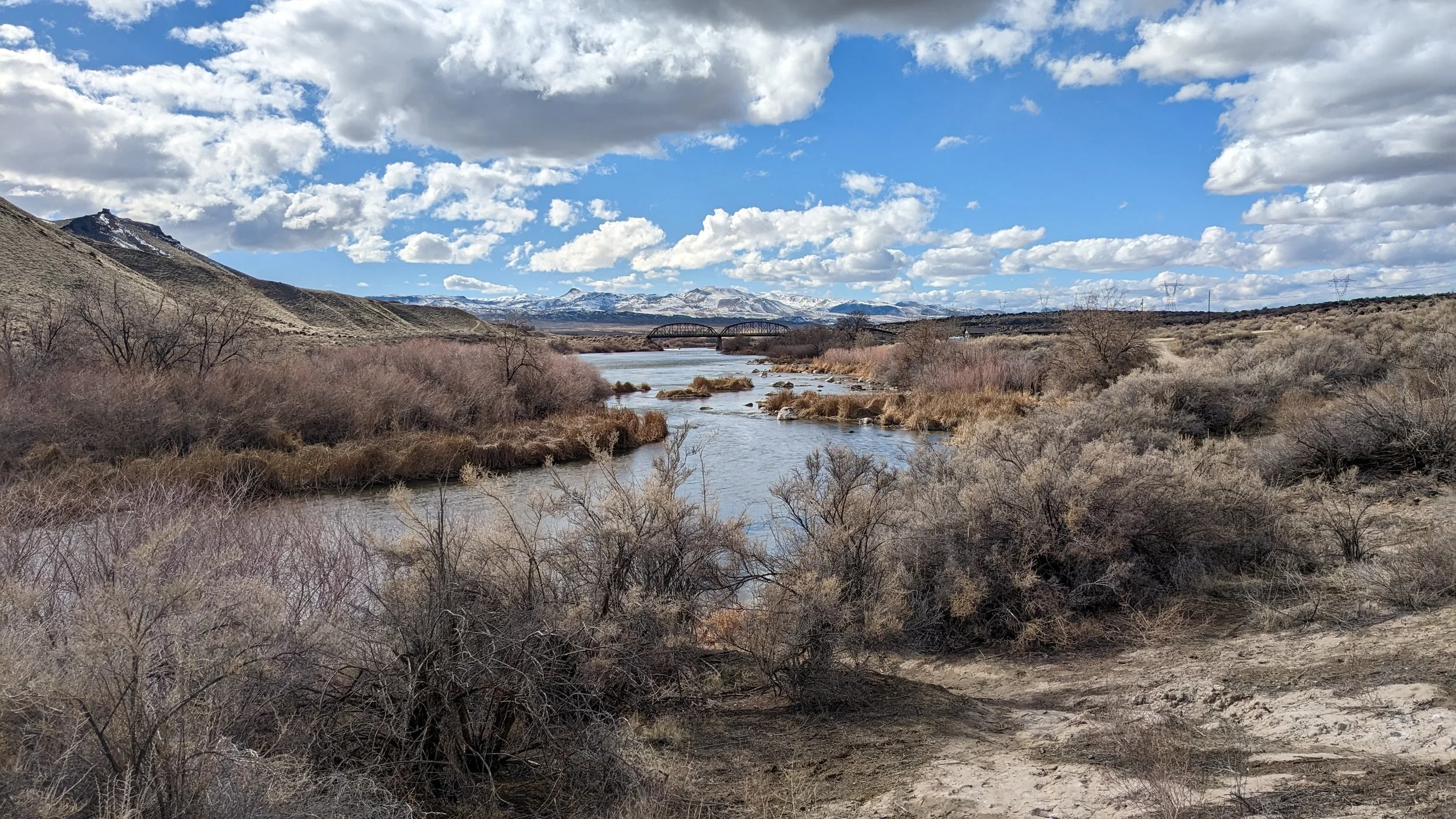
The hike back to the trailhead is a little shorter but gives you the views you were missing on your hike in. There is a particularly picturesque spot as you near the visitor center parking lot. You can walk down near the river and take in a great view of the bridge crossing the Snake River, with the Owyhee Mountains in the background and the river in the foreground.
Back at the parking lot, you can take some time to explore the park a little. There are information boards explaining some of the park's features. A dedicatory stone sign that explains the history of the area, bridge, and park. This sign is really hard to read if you stand directly in front of it, but if you stand off to one side it makes it a little easier. If you have the time (30 minutes) you can walk the Petroglyph Trail and see some incredible history. If you have even more time and it is between 10 am – 2 pm, you can ask to try out the atlatl range in the visitor center. Next month, I’ll go over the Petroglyph Trail and the Atlatl range.